12/14/2010

Weekend Rains Wash Tree Debris Into Sooke River Estuary

Although everything is calm on the Sooke River estuary today, the weekend was a different story. A record rainfall flooded the Victoria region with a deluge that put many local roads under water. Another winter day in the rain forest.

When we get these strong winter storms the Sooke River becomes Mr. Hyde to the drought seasons calm, well-mannered Dr. Jekyll. Water levels rise quickly in a big storm, and erosion muddies the normally clear water. And as the river crashes down through the forest covered hills it washes out all kinds of debris that eventually ends up in the estuary and harbour.

On the weekend the soupy water was moving fast and carrying everything from silt to single trees. Severe winter storms such as the one we had on the weekend are an exciting time to be in the rain forest, if you don't have to drive Highway 14.

All is calm today, but the new wildlife trees are evidence of the high waters
It is always fun to see the new tree debris added to the estuary. Some will wash away with the next high tide, and other large debris may be around for years or decades. However long they stay, they will add diversity to the estuary. The trees thrive with life, although not their own.

The estuary wildlife trees host an abundance of life, the most obvious of which are the birds. Eagles frequently use their favourite trees to perch on or to eat a meal of duck or sea gull. Cormorants sit on logs facing the sun with wings spread wide. Gulls like to captain logs as they float around with the currents and tides.

River otters are also regular users of wildlife trees for playing on, slumping across and sleeping in a sunbeam, or for holding a crunchy crab lunch.

Eagles hanging out on a Western red-cedar wildlife tree in the Sooke River estuary
 It is amazing to see the power of the river to deposit huge trees into Sooke Harbour during winter storms. During dry summers it might be hard to float a small branch down the meager trickle. In winter it turns into a white foam raging torrent.

The trees that the high water brings continue to add to the diversity of the coastal rain forest. In addition to the structure that they add, nutrients that the salmon brought into the forest from the sea are now being returned to the sea.

12/09/2010

Mapping Significant Arbutus of Vancouver Island

Detail of Arbutus in Roche Cove Park, Sooke


This map augments a post I did on one of British Columbia's most beautiful and unique native trees - the Arbutus. The interactive map highlights some of the significant Arbutus on Vancouver Island, mostly in the Victoria and S. Island area where the peeling bark evergreen trees are most common.


View Victoria and S. Island Big Arbutus in a larger map

Click on the tree icons for more information.

Some of the Arbutus noted are street trees in urban areas, while others can be found in more natural and remote settings. All are amazing trees surviving in a harsh, coastal environment. Often living on rocks in marginal soil not far from the ocean, these tough trees withstand constant pounding from water and wind storms. When a calmer summer arrives, Arbutus are denied water for extended lengths of time during these droughts. 


Big Arbutus and Douglas-fir, Roche Cove Park, Sooke
Click on photo for larger image.

You can use the map above to learn more about Arbutus. You can use the tree icons, or zoom in to view more detailed maps. Try using 'Street View' by pulling the little person icon (on the top left) down to the street you would like to view. It will give you a view of the street as if you are driving a car.

This is a very interesting, low carbon method to see some of the urban trees without leaving your own home. A good rainy day winter activity.


Do you have a favourite  Arbutus on Vancouver Island? Please leave a comment below letting us know where it is.

12/05/2010

Arbutus - Canada's Only Native Broad-leafed Evergreen Tree

B.C.'s largest circumference (7.8 meters) Arbutus, Dockyards CFB, Esquimalt
Arbutus, or Pacific Madrone, are magnificent trees that grow along the west coast. In British Columbia, Arbutus (Arbutus menzeisii) is found in the dry southeast regions of Vancouver Island, the Gulf Islands, and bits of the lower mainland. They are very distinctive trees that frequently grace artists renderings of the area, clinging to the rocks and standing up to gale force winds.

Arbutus are found as far south as Mexico, giving this tree one of the longest north-south ranges of any North American tree. It is Canada's only native broad-leafed evergreen tree, and usually resides not farther than 8 km from the pounding waves of the Pacific ocean.

Arbutus in Roche Cove Regional Park, Sooke
These unique and striking trees live in quickly drained, shallow, nutrient-poor soils on rocky outcrops. In these locations trunks commonly split into several main branches close to the ground, creating massive canopies of red, orange and chartreuse coloured twisted branches. Arbutus are sun loving trees.
Huge canopy of Arbutus in Roche Cove Regional Park, Sooke
Arbutus are also found in dry, open forests in deeper soils, where they grow a single tall trunk before branching farther up to make a compact crown. Arbutus are commonly found with other drought-tolerant trees such as Douglas-fir and Garry oak.

Largest (398 AFA points) known, and tallest (35.54 m), Arbutus in B.C., Thetis Island

Arbutus are not known for sustaining damage in wind storms. This is partly because their wood is dense and strong. Heavy wet snow, on the other hand, can break their branches.


Arbutus flowers and leaves, Shaun Hubbard photo
Arbutus leaves are oval shaped and have a leathery texture. The tree sport bunches of small, bell-shaped white flowers that bring a fragrant essence to the forest at the water's edge every spring. Their red berry is edible, and birds such as waxwings and robins dine on them.

Arbutus bark has a variety of appearances depending on its age
Arbutus does not drop all its leaves in the fall, although the trees reddish bark peels off revealing the smooth, new green bark underneath.

These are tough trees that weather summer drought conditions well, and prefer very dry to moderately dry soils.

If they are damaged by fire they are able to sprout fresh growth from the trunk, giving them an advantage over fire damaged conifers. Fire is not much of a threat these days, though, but forms of fungus are. Many of B.C.'s Arbutus are suffering from different forms of fungus, including root rot, which is damaging and killing a number of trees. Scientists believe this is due to stresses put on Arbutus by unusually dry winters. Habitat loss is also a threat.

On south Vancouver Island just about any coastal area will feature notable Arbutus. Regional parks are good places to see these amazing trees. Witty's Lagoon Regional Park in Metchosin features some very large Arbutus. Beach Trail, which starts next to the Nature Center, takes the hiker past one of the largest and oldest Arbutus in the area.


Giant Arbutus at Witty's Lagoon Regional Park
Other places to view Arbutus are Roche Cove, and East Sooke Regional Parks. Victoria has many large urban Arbutus. Also in the Victoria area, the Saanich Peninsula has many notable Arbutus.

Enjoy the many opportunities Vancouver Island has for viewing Canada's only native broad-leafed evergreen tree. Some of the best Arbutus habitat (and individual specimens) in B.C. can be found here.

11/30/2010

BC Ministry of Forests and Range Research Branch Disbanded After 80 Years of Service

Pipestone Inlet near Ucluelet, from BC Ministry of Forests, Mines and Lands
Barbara Hawkins is a professor in the University of Victoria Centre for Forest Biology and a registered professional forester. She has been involved in forest research in B.C., New Zealand and Thailand for 25 years. The following is an article she published in Victoria's Times Colonist newspaper November 26, 2010:

Unnoted last week amid the political confusion, British Columbians lost a venerable institution. After a proud, 80-year history, the research branch of the Ministry of Forests and Range was disbanded. It is ironic, in the government's self-declared Year of Science, that it should dismantle such an internationally respected scientific institution.

B.C. is a world leader in many areas of forest research. Our excellent reforestation record, forest genetics program, long-term growth and yield experiments, forest growth models and ecologically based biogeoclimatic classification system were founded on sound science and are the envy of many countries.

The research was conducted collaboratively by provincial, federal, university, industrial and community institutions. Scientists from each of these institutions have distinct priorities and capabilities, and one cannot replace the other. University and industry scientists cannot provide the continuity and long-term commitment needed for some types of forest research.
The loss of a united, cohesive research branch is a loss to us all.

At a time when the need for forest research is pressing, the government's lack of support is baffling. In the past two years, the Forest Investment Account forest science program has been cut, eliminating competitive funding for forest researchers in all institutions, and the research branch suffered layoffs of approximately 25 per cent of its staff. Last week, the final blow was to disperse the remaining staff in the research branch to four separate ministries.

Climate change is already having dramatic impacts on our forests, with more likely to come and the forest industry is in an obvious state of change. B.C. needs to position itself to maintain healthy, productive forests providing sustainable ecosystems and raw materials for a diversified forest industry. This can only be achieved through sound basic and applied research and monitoring built on long-term vision.
No rationale has been given for the drastic changes within the Ministry of Forests and Range. Doubtless, government ministries, like trees, are improved by judicious pruning. A tree cut off at its roots, however, does not bear fruit.

11/29/2010

Snow In The Coastal Forest

View from Willis Point, Carolyn Rowins
Winter is a dangerous time for coastal trees and forests. Snow, ice, and wind can combine forces with devastating effect. Powerful winter storms are nature's tree trimmers and fallers. They also create havoc for those of us living under the trees.

In Vancouver Island's recent snowfall many residents were without power for up to a day. The snow came with record cold temperatures for November, so a day without power would be uncomfortable for the unprepared.

Last year there was not a flake of snow at sea level in Sooke, but the year before that there was snow on the ground for several weeks in a row. Winter is unpredictable along the coast.

Trees heavy with snow at Cobble Hill, Christina D.
When coastal snowfalls happen they tend to be of the heavy, wet variety. Sometimes the weight of snow causes trees to lose their tops or a few branches. When conditions are right trees wobble under the load and fall down. Often they take power lines with them.

Having the power go out can be an inconvenience, but it almost seems worth it to see the forest altered and transformed. Snow covered individual trees stand out from the common background of forest. All is quiet and muffled. It is a rare treat.

Ultimately, damaged, injured or toppled trees end up creating more diversity in the forest environment as other living things take advantage of storm damaged trees for food and habitat. Winter can be a beautiful and powerful agent of change in the forest.

11/26/2010

Giving Thanks For The Trees

Giving thanks for the big trees in Cathedral Grove, Vancouver Island

Any time is a good time to stop and acknowledge the true value of our trees and forests. Beyond beautiful, they provide habitat and services to support a profusion of life, including humans. Old growth trees and forests provide more value standing than cut down. They freely give day in and day out. Let's be thankful for the trees.

photo from: oakvilleandbeyond.com

11/22/2010

The Chipko Movement: Hugging And Saving India's Trees Since 1730

Villagers surround tree to protect it from the axe
"We have arisen, we are awake
No longer will thieves rule our destiny
It is our home, our forests
No longer will the others decide for us"

- Chipko protest chant 

The Himalayan region of northern India is a stunning land rich in natural resources. A wide diversity of forests cover regions from flat, low plains to the tree line in alpine areas of the highest mountain range in the world. This is also the land of the original tree huggers, the brave women of the Chipko Movement.

In India, as here in B.C., the forests have been under assault for a long time. The Chipko Movement is a decades old initiative of the people to address the serious problems of deforestation and corporate control. Chipko means 'to stick' or 'to hug' in Hindi.

Although the first recorded use of tree hugging to protect forests in India was in 1730, the movement took its modern form in the 1970's. At that time the state of Uttarakhand was experiencing heavy logging pressure from outside corporations after new roads made previously remote forests accessible. 

The people that lived in, or near the forests were suffering the consequences of the greedy industrial practices. The women, who were closest to the forest resources, suffered the most when they began to disappear.

Villagers had to walk farther to gather fire wood and fodder for their livestock. Water sources were drying up affecting availability of water for drinking and irrigation. Erosion on deforested areas during the monsoon was scaring the land and creating devastating floods. 

All the profit from the deforestation was taken away, rather than benefiting the local economy. The people were increasingly dissatisfied with commercial logging and government forest policy.

Artwork by Notnarayan
1973 saw the first confrontation over the looming ecological disaster. Tired of inaction on the part of the government, the women of the Chipko Movement decided to protest the destruction of their forest directly. 100 activists banged drums and shouted slogans where the logging activity was taking place. The loggers retreated, and eventually their contract was canceled and given to the villagers.

More protests took place in different areas. Where the people were threatened and ignored the protesters embraced the trees to protect them from being cut. They would often maintain their vigils for days at a time before the loggers retreated.

When news of the growing movement reached the state capital a commission was called which eventually ruled in favour of the Chipko activists and the people most affected by the environmental collapse. For them it was an issue of life or death.

In 1980 Prime Minister Indira Gandhi's government banned the cutting of trees in the Himalayan regions for 15 years to allow forests to recover.

The Chipko Movement is still going strong as a major socio-ecological movement, and has served as a model for similar groups across the world. The movement has been successful in returning forests to community control for the sustainable benefit of local communities. 

Fortunately they did not have to sacrifice their lives for the trees as did the 363 slain tree huggers in the original 1730 Chipko protest.

11/15/2010

Ella Beach: Big Trees On The Edge

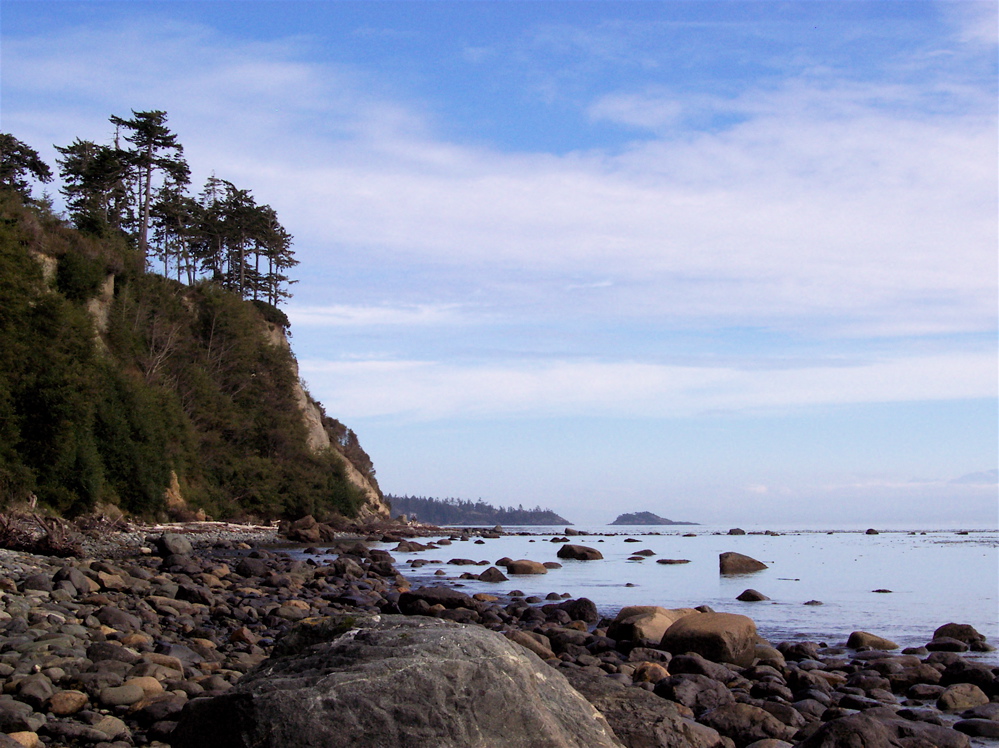
Big trees on the edge along the coast near Sooke
Vancouver Island has 3,500 kilometers of coastline, and along much of that you will find trees. These trees are at the edge living a very precarious existence. This is where the sea meets the land, and the water meets the wood. It is a wild and ever changing battlefield, and ultimately the land and trees give way to the persistence of the wind and waves. Sooke's west-facing Ella beach is a great place to see the interaction of land and sea, and witness how big trees cope in this dangerous zone.

Looking up at a downed Sitka spruce waiting to slide into the ocean
Wind, rain, and waves all slam into land here, constantly shaping the trees while eroding the land around them. On the night of December 15, 2006 a mega-storm hit the south coast. Hurricane force winds of 158 km/hour were recorded at Race Rocks, not far from here. The storm knocked down thousands of trees along the coast that night, and many ended up in the ocean becoming drift logs.

Eventually the tree in the distance will join others on the beach
Many of the biggest trees along Ella beach are Sitka spruce. These trees are not found further than about 80 km from the ocean, and have adapted to the salt spray near the surf. It is believed that not only do these trees tolerate salty or brackish conditions, but actually benefit from the various minerals found in ocean spray and salty soil.

Sitka spruce often have shallow root systems as many begin life on top of downed trees or 'nurse logs'. This makes them susceptible to blow down later in life. Sitka spruce can live for up to 800 years, but it is unlikely that those growing in exposed, easily eroded areas will make it that far. The oldest trees I saw along Ella beach are probably half that age.

Big Sitka spruce along Ella beach in a low bank, sheltered setting
There are also big Douglas-fir along the coast here. Many of them are also being swept into the ocean. Some will end up on the beach somewhere in the area. Others may make a major crossing on ocean currents and wash up on beaches on the Hawaiian Islands. Historically such logs making the crossing from North America were sought after by the Hawaiians for building canoes.

This Douglas-fir holds on against all odds
The terrain along this stretch of coastline varies from walk-on beach at the Ella Road access, to towering sheer cliffs closer to town. Hiking here you can see the graphic results of the ocean/land interface as everything is eventually eroded away.

This Douglas-fir, anchored by roots growing into the cliff, hangs suspended in the air
This ever changing, dynamic zone where the ocean meets the land constantly provides interesting surprises. Ella beach in Sooke is an excellent place to view big trees on the edge - a perilous spot where the ocean always wins.

Getting There


View Ella Beach in a larger map

11/10/2010

Avatar Grove - Accessible Ancient Forest Marked For Logging

Baird Creek Bridge and Avatar Grove  (see truck on right)
As I approached the Baird Creek bridge 20 minutes north of Port Renfrew on the Gordon River Main logging road, I realized I had been here before. A few years ago I stopped, took pictures, and sat on the bridge for a while. I admired the view of the canyon below, as well as the tops of huge trees and candelabra Western red-cedar poking out of the forest canopy. But unlike a recent trip, back then I didn't take a few steps off the road and enter the forest. But back then it wasn't called Avatar Grove.

Shady, moist forest floor and big trees everywhere

Take those few steps off dusty Gordon River Main and you step into a different realm. From civilization, gravel and harsh sunlight you descend into a wild, moist, lush, shady forest. A forest that grows some of the biggest trees on Earth, and contains the most biomass of any forest anywhere. This is Avatar Grove.


Members of the Ancient Rainforest Alliance (AFA) stepped off the logging road in December of 2009, and when they did they found massive old growth trees. They were looking at a forest that has survived over 100 years of industrial logging in the Port Renfrew area.

Recognizing its value as a standing forest, they named it Avatar Grove after James Cameron's movie and began to push for protection. But they found more. The AFA team also discovered that the area was surveyed and flagged for logging.

A survey blaze on a small tree in Upper Avatar Grove
I thought I had better take a look before it was gone, and mounted a fall field trip to Port Renfrew on a glorious, crisp, sunny day.

Mushroom and moss


At the grove, as soon as I was through the thick barrier of bush growing alongside the road I stepped out under a shady canopy far above. The ground was moist and spongy and my feet sunk into the thick layer of debris. Everything was covered in moss, which can hold 1000 times its own weight in moisture. Once logged such areas all but dry out in the harsh direct sunlight.


In Lower Avatar Grove the ground is sloped gently down to the Gordon River. A rough trail has been flagged out, but there are also many logging survey flags so one must exercise caution. I forged ahead, excited to finally be checking out this wonder so close to home.

After my eyes adjusted to the shade I began to see giant trees spread around the forest below. All the tell-tale signs of old growth forest are here: a variety of ages of trees from seedlings to seniors, standing dead trees (or snags), large diameter woody debris (fallen giants), and a deep layer of decaying matter on the forest floor.

Large diameter woody debris is everywhere - downed logs can take centuries to decay
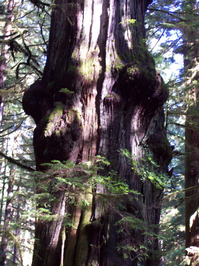
The rough path leads the big tree hunter to some spectacular individual behemoths. There are some very large Douglas-fir, but the real stars here are the amply aged and weathered Western red-cedars. They are big and gnarly, and unlike any cedars I have seen. Most of the largest cedars are festooned with burls and whorls that are unique in their twisted beauty.

Ancient Western red-cedar in Lower Avatar Grove
The big Douglas-firs are dark and ominous looking, and far above the twisted and broken tree-tops poke out of the canopy and catch the last light of the day.

Big Douglas-fir in Lower Avatar Grove

I lost the trail on the way back up to the road, but there is little undergrowth and many fallen logs to walk along. It is hard to get lost here as all you need to do is point yourself uphill and hike till you hit Gordon Main, which is what I successfully did.

Giant tree broken off at the top, but still tall enough to poke above the rest


Back on the dusty gravel it seemed hard to believe that I have drove right through the middle of this old growth forest several times over the years without ever knowing what treasures lurked just a meter off the road. I ran up into the upper grove for a few brief minutes and look forward to returning at a later date for a more extensive upper grove excursion.


Lower Grove - big moss covered trees everywhere

See Avatar Grove

Leave Victoria and take Hiway 14 to Sooke, check gas gauge, then continue to Port Renfrew.
At Port Renfrew turn RIGHT onto Deering Rd. Follow Deering Rd. until the T intersection, then turn LEFT (right is toward Lake Cowichan). Follow road until the bridge over the Gordon River. Cross the bridge and stay on Gordon River Main for about 1.5 km. Right after you cross over the single lane bridge at Baird Creek, pull off to the right and park. Trail access has been marked by AFA on both sides of the road. Visit gently - be respectful. Enjoy the trees.


View Avatar Grove in a larger map

Save Avatar Grove

You would think that a bit of ancient forest on a well kept main logging road only 20 minutes from Port Renfrew would make someone in government think about preservation and tourism potential. Avatar Grove is on Crown land, so saving this valuable forest treasure would not entail purchasing land from a greedy logging/development company.

Please consider contacting elected officials to let them know preservation is the most logical thing to do with this increasingly rare piece of primeval forest, and the massive trees that thrive in it. Let them know that cutting thousand year old trees for pulp, paper, and deck lumber is greedy and unnecessary.
 

11/05/2010

Mary Lake: Help Save Original Coastal Douglas Fir Forest


It is not often that people have a chance to help preserve a bit of the original Coastal Douglas Fir (CDF) ecosystem here on Vancouver Island. Mary Lake, in the rural and rugged Highlands district outside of Victoria, B.C., presents such an opportunity.

A group dedicated to preserving Mary Lake, and the surrounding 107 acres of undeveloped forest, are attempting to raise the money to purchase it. See more here, and consider lending them a hand in reaching their worthy goal of saving some of this beleaguered ecosystem.

The CDF ecosystem is tiny, the smallest eco-zone in B.C., yet it holds a greater variety of plant and animal life than any other ecosystem in the province. The zone is restricted to a small strip of southeast Vancouver Island, as well as parts of the Gulf Islands and bits along the coast on the mainland. On the island, this vanishing ecosystem runs through the rainshadow created by the Vancouver Island and Olympic ranges.

This dry strip along the east coastal plain, until fairly recently, contained some of the biggest trees in the world. The size and scope of the original forest was an irresistible economic gold mine to early European settlers. Today 99% of one of the world's most productive and massive forests is gone.

Even the 1% that remains is being exploited before it too disappears. Only about 5% of the CDF zone is protected in parks - the B.C. government's goals is 12%.

The government has known for a long time that the CDF forest is in peril. In 1999 the B.C. Ministry of Environment stated in its Ecosystem at Risk brochure that "nearly every type of old growth Douglas-fir forest on British Columbia's dry coastal plain is now rare or endangered".

Knowing this, the government gave the go-ahead earlier this year for logging to commence on District Lot 33 in Nanoose Bay. Lot 33, a 64 hectare plot in the CDF zone, contains huge old growth Douglas-fir and Western red-cedar. It has never been inventoried for its biological wealth, and is prime habitat for the Marbled murrelet and Spotted owl.

Industrial use, logging, and increasingly, residential development, threaten the dry coastal plain that lies next to Georgia Straight.

Indeed, it is residential development that threatens the Mary Lake forest in Highlands. But we currently have the opportunity to save this 107 acres of endangered forest. Please consider donating, and/or volunteering. Also, consider writing to our elected officials to tell them that you do not want to see Vancouver Island's CDF forest go extinct on their watch.

Where is Mary Lake? 

Mary Lake is in the district of Highlands off Millstream Road, a 20 minute drive northwest of Victoria, B.C. The land is currently private, and having not visited yet, I can not say what access is like. However, I did see somewhere online that said that there are area trails that locals have been using over the years. As always, be respectful when visiting the big trees.


View Mary Lake, Highlands, B.C. in a larger map